Land Survey
Services
Deliverables

A boundary survey precisely determines property lines and corner markers to resolve disputes and establish clear land boundaries.
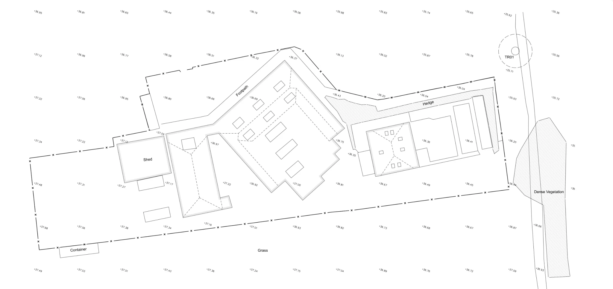
A topographic survey maps land features and elevations, providing key data for design and construction projects.
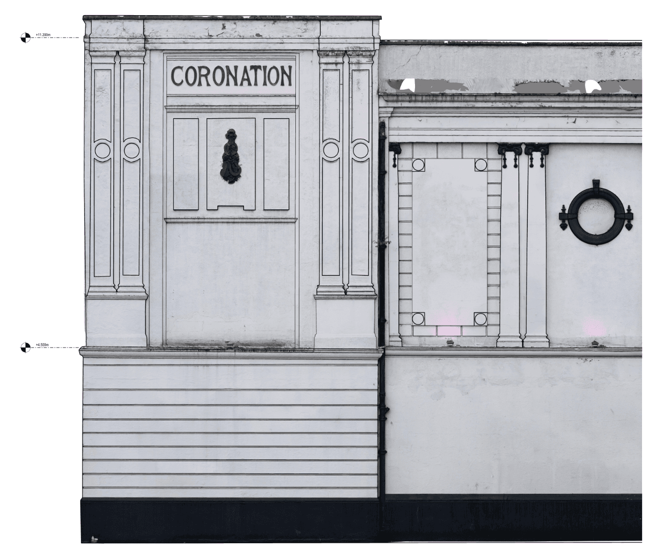
A measured building survey accurately captures the dimensions and layout of a building, providing detailed floor plans and elevations
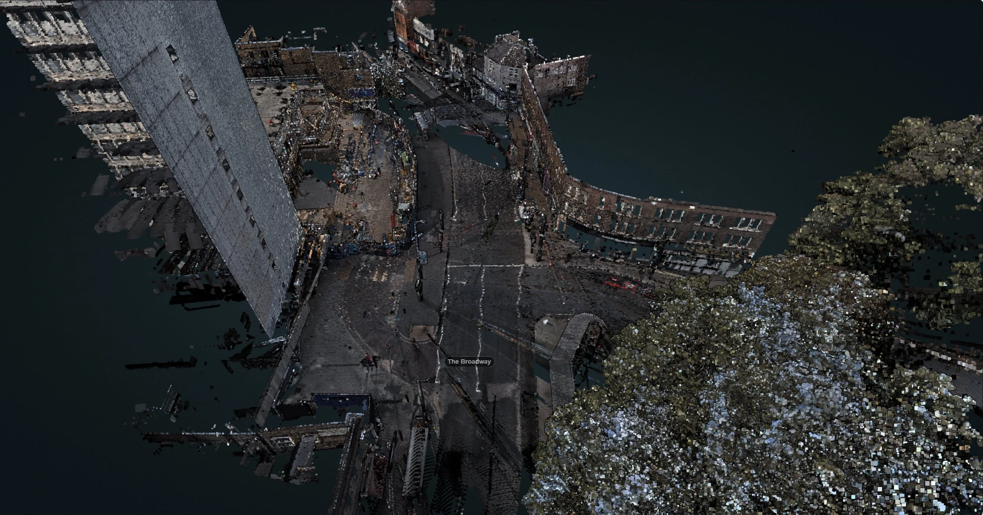
A 3D laser scan survey captures highly detailed, accurate measurements of a site or structure, creating a precise digital model for analysis and planning.
Services
Deliverables
A boundary survey precisely determines property lines and corner markers to resolve disputes and establish clear land boundaries.
A topographic survey maps land features and elevations, providing key data for design and construction projects.
A measured building survey accurately captures the dimensions and layout of a building, providing detailed floor plans and elevations
A 3D laser scan survey captures highly detailed, accurate measurements of a site or structure, creating a precise digital model for analysis and planning.


© Frame Bound Surveys 2025
© Frame Bound Surveys 2025
© Frame Bound Surveys 2025
© Frame Bound Surveys 2025